Unlock decades of geological
data for modern exploration.
Mining companies and exploration teams use Monarcha to digitize legacy maps, structure drill data, and build unified geological databases, faster than manual entry ever could.
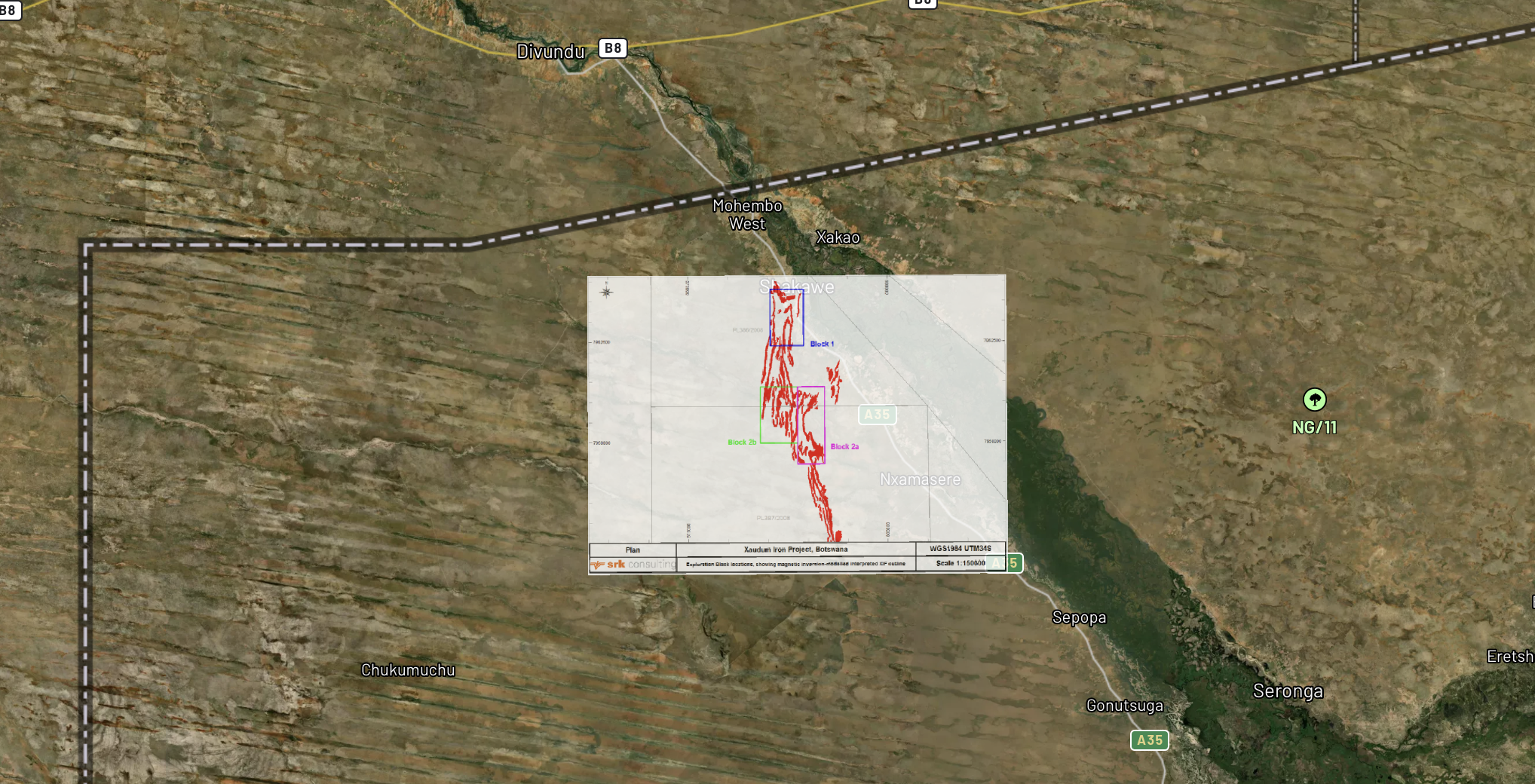
Geological map with digitized block boundaries near Mahambe, Tanzania
Exploration blocks and geological contacts extracted and georeferenced over satellite imagery
Challenges we solve
Legacy data recovery
Decades of geological maps, drill logs, and assay results locked in paper archives. Monarcha extracts and structures them for modern analysis and resource modeling.
Exploration data unification
Combine data from multiple campaigns, contractors, and eras into a single, consistent digital dataset with standardized schemas and coordinate systems.
Compliance and reporting
Rapidly compile and cross-reference historical data for NI 43-101, JORC, and environmental compliance filings with full audit trails.
Due diligence acceleration
Digitize and query an acquisition target's entire geological archive in days instead of months during M&A due diligence.
How Monarcha fits in
Georeferencer
Align geological maps, mine plans, and exploration grids, including custom mine grid coordinate systems.
Learn more →Document Extraction
Extract collar coordinates, intervals, grades, and lithology from drill logs and assay certificates at scale.
Learn more →Search & Query
Query across your entire geological archive: "show all holes with Cu above 1% within 500m of the main zone."
Learn more →