Turn land records into
actionable spatial data.
Data center developers, energy companies, and real estate teams use Monarcha to extract zoning classifications, parcel boundaries, and land-use data from county records, accelerating site selection, permitting, and due diligence.
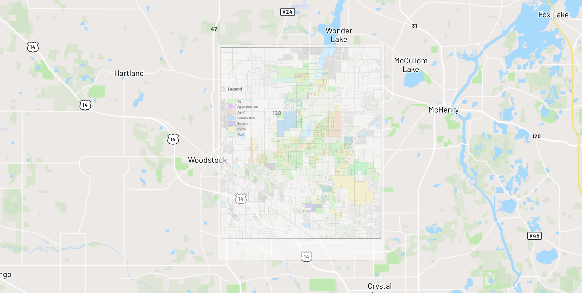
Zoning map georeferenced near Woodstock, McHenry County, Illinois
Zoning districts with land-use classifications digitized and overlaid on modern basemap
Who uses this
Data center site selection
Rapidly assess zoning compatibility, setback requirements, and utility easements across hundreds of candidate parcels. Convert county zoning maps into queryable GIS layers for faster go/no-go decisions.
Energy development & solar siting
Extract land-use classifications, environmental constraints, and parcel ownership data from scanned county records to evaluate sites for solar, wind, and transmission projects.
Sales tax & property assessment
Digitize historical assessment maps, property boundaries, and tax district records. Link spatial data to valuation records for accurate, auditable property tax analysis.
Real estate & land acquisition
Convert deed records, plat maps, and survey documents into spatial data to accelerate title research, boundary verification, and acquisition due diligence at scale.
From paper to digital
How Monarcha fits in
Georeferencer
Align scanned plat maps, zoning maps, and survey sheets to state plane or UTM coordinate systems for overlay with parcel databases.
Learn more →Digitizer
Extract zoning districts, parcel boundaries, easements, and municipal limits as attributed vector layers ready for GIS.
Learn more →Document Extraction
Structure deed descriptions, permit records, and zoning ordinance text into queryable, spatially linked data.
Learn more →