From engineering drawings
to GIS-ready spatial data.
Engineering firms and public works departments use Monarcha to convert as-built drawings, site plans, and legacy project archives into accurate, georeferenced digital data.
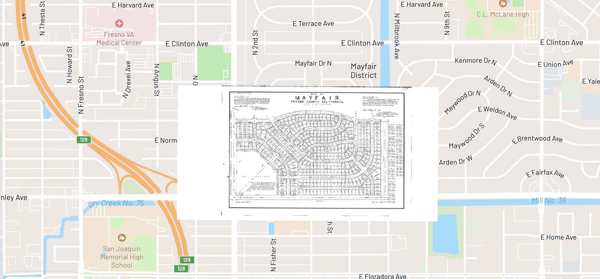
Mayfair subdivision plat georeferenced over Fresno County, California
Parcel lot lines, street layouts, and subdivision boundaries aligned to modern GIS coordinates
Document types we handle
As-built drawings
Georeferenced and digitized into vector layers with utility types, pipe sizes, and material attributes.
Site development plans
Building footprints, setback lines, stormwater features, and utility corridors extracted as spatial data.
Grading and survey sheets
Contour lines, spot elevations, and grade breaks converted to elevation models and 3D surfaces.
Utility maps
Water, sewer, electric, gas, and telecom infrastructure digitized with connectivity and attribute data.
Construction specifications
Material specs, testing requirements, and installation standards extracted and linked to spatial features.
Geotechnical reports
Boring logs, soil classifications, bearing capacities, and foundation recommendations structured and geolocated.
From paper to production
Upload
Scanned as-builts, PDFs, or CAD exports
Georeference
AI aligns to real-world coordinates
Digitize
Features extracted as vector layers
Export
Shapefile, DXF, GeoJSON to your GIS
How Monarcha fits in
Georeferencer
Align site plans, as-builts, and survey drawings to real-world coordinates for overlay with existing GIS data.
Learn more →Digitizer
Extract building footprints, utility lines, grading contours, and property boundaries from engineering drawings.
Learn more →Document Extraction
Structure soil reports, geotechnical data, and construction specifications into organized, searchable records.
Learn more →