Modernize public records
and land data at scale.
County assessors, city planning departments, and state agencies use Monarcha to digitize aerial imagery, ROW maps, parcel plats, deeds, and as-built drawings into accurate, searchable GIS data.
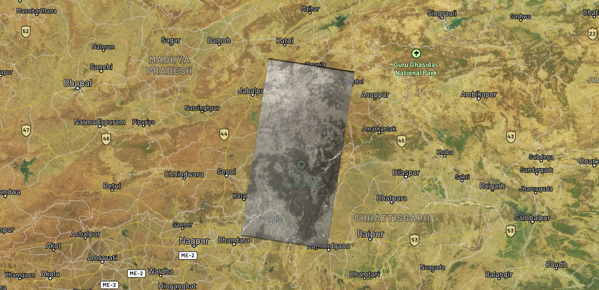
Declassified satellite imagery georeferenced over Madhya Pradesh, India
Historical satellite capture aligned to modern basemap coordinates
Aerial & satellite imagery
Georeference drone captures, satellite imagery, and aerial photography for overlay with existing county GIS layers and parcel data.
Deed & plat digitization
Convert recorded deeds, plat books, and survey records into spatially accurate, searchable digital records linked to parcel IDs.
ROW & as-built conversion
Transform right-of-way maps, as-built drawings, and utility records into GIS-ready layers for public works and infrastructure management.
Challenges we solve
Legacy record modernization
Decades of paper maps, plat books, deeds, and survey records digitized and georeferenced. Make them searchable, shareable, and compliant with modern GIS standards.
Aerial imagery alignment
Align satellite, drone, and plane-captured imagery to authoritative parcel grids and coordinate systems for seamless integration with county GIS portals.
Permit and zoning automation
Extract parcel data, setback requirements, and zoning classifications from scanned documents to accelerate permit processing and reduce manual lookup time.
Public records accessibility
Make historical maps, property records, ROW documents, and land-use data searchable and available to citizens through digital portals and open data platforms.
How Monarcha fits in
Purpose-built tools for the unique demands of government geospatial data.
Georeferencer
Align aerial photography, drone captures, historical survey maps, and plat books to state plane or UTM coordinate systems.
Learn more →Digitizer
Extract parcel boundaries, ROW corridors, road centerlines, utility easements, and zoning districts from scanned maps.
Learn more →Document Extraction
Structure permit records, deed descriptions, and regulatory filings into queryable, spatially linked data.
Learn more →