Turn maps into data.

Black and white topographic map with contour lines indicating elevation changes and landforms.
Topographic map with contour lines, showing terrain elevation and landforms.
Topographical map with contour lines in black and white representing terrain elevation.

Monarcha's AI-powered geospatial platform unlocks accurate spatial data for mining, infrastructure, and land intelligence.

Request a Demo →
Start Now
A map superimposed on a satellite image of the Superstition Mountains and surrounding area in Arizona, showing different geological zones in various colors.
A technical diagram showing a layered geological survey with a topographic map on top and a satellite image underneath, connected by lines.

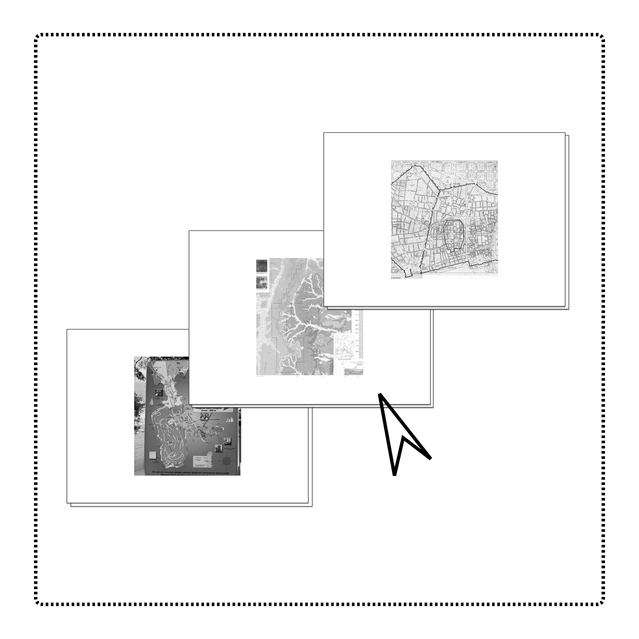
AI-Powered Georeferencing

Make complex documents queryable spatial data. Industry-leading vision AI that delivers unmatched accuracy in 90 seconds or less.

A collage of four sections showing land survey documents. The top right section labeled 'Land Descriptions,' the middle right labeled 'Plotted Geometries,' the lower right labeled 'X-Y Coordinates,' and the bottom right labeled 'Attribute Metadata.' The left section appears to be a detailed site plan or survey map with topographic lines and annotations.

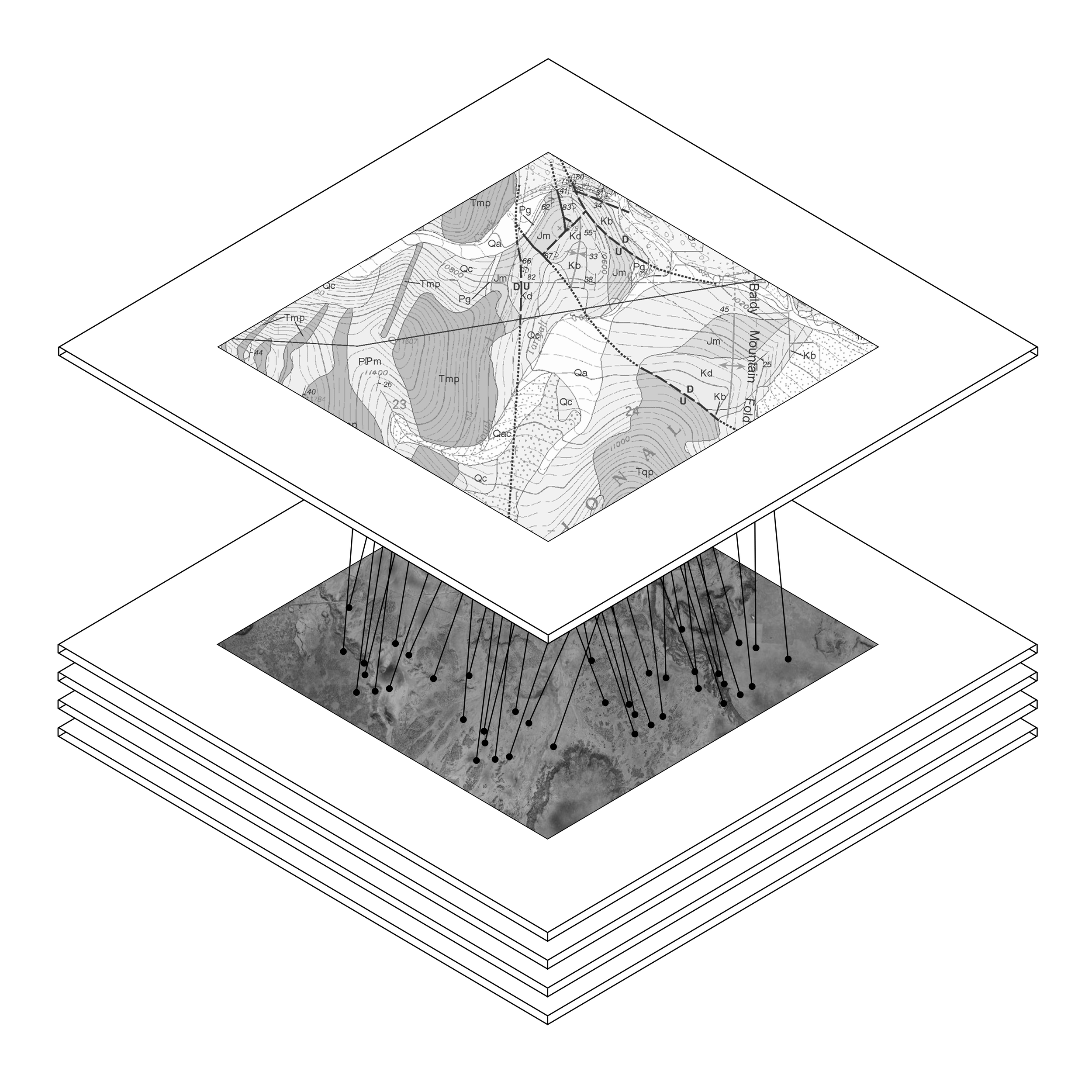
Structured Spatial Output

Each document becomes a dataset. Monarcha extracts land descriptions, coordinates, and plotted geometries, instantly transforming text and imagery into queryable GIS layers.

Image showing three maps overlaid, one of a mountainous terrain, another of a detailed urban street plan, and a third of a park or nature area.

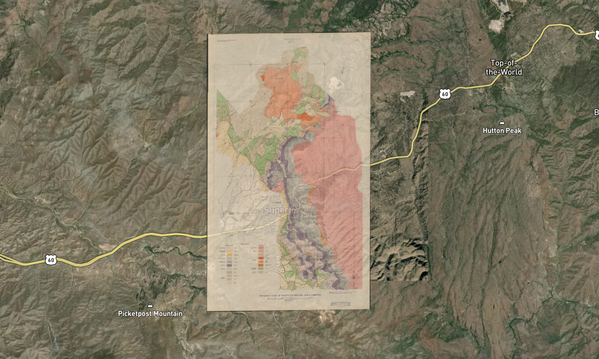
Universal Document Ingestion

Upload scanned maps, plats, deeds, or drawings. Monarcha processes every format from PDFs to images, and aligns them precisely to coordinates

Book a Demo
Start Now